Malt House, Brockweir
Introduction
The photograph on this page of Malt House, Brockweir by Derek Harper as part of the Geograph project.
The Geograph project started in 2005 with the aim of publishing, organising and preserving representative images for every square kilometre of Great Britain, Ireland and the Isle of Man.

There are currently over 7.5m images from over 14,400 individuals and you can help contribute to the project by visiting https://www.geograph.org.uk
Malt House, Brockweir
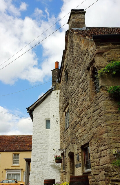
Image: © Derek Harper Taken: 25 Jun 2021
The grade II* listed building is described as "dwelling and workshop or store, sometime malt house, now dwelling and pottery" at https://historicengland.org.uk/listing/the-list/list-entry/1186590?section=official-list-entry but, having been holiday accommodation, it now seems to be a five-bedroomed home. The building has distinctly different exteriors, with "original block in sandstone rubble with some carving on the principal south front, remainder painted rubble ... a two-storey original C15 or C16 block with gable to road, with later 2½ storey building forming an L, and C19 infill ... a complex historical growth ..." See other images at https://www.geograph.org.uk/search.php?i=161618229 . The Offa's Dyke Path runs past, turning left at the junction with Mill Hill. Ahead is the listed former Post Office; see Image
Images are licensed for reuse under creativecommons.org/licenses/by-sa/2.0
Image Location
Latitude
51.707008
Longitude
-2.667541