Brook Street estate, New Brook Street, Royal Leamington Spa
Introduction
The photograph on this page of Brook Street estate, New Brook Street, Royal Leamington Spa by Robin Stott as part of the Geograph project.
The Geograph project started in 2005 with the aim of publishing, organising and preserving representative images for every square kilometre of Great Britain, Ireland and the Isle of Man.

There are currently over 7.5m images from over 14,400 individuals and you can help contribute to the project by visiting https://www.geograph.org.uk
Brook Street estate, New Brook Street, Royal Leamington Spa
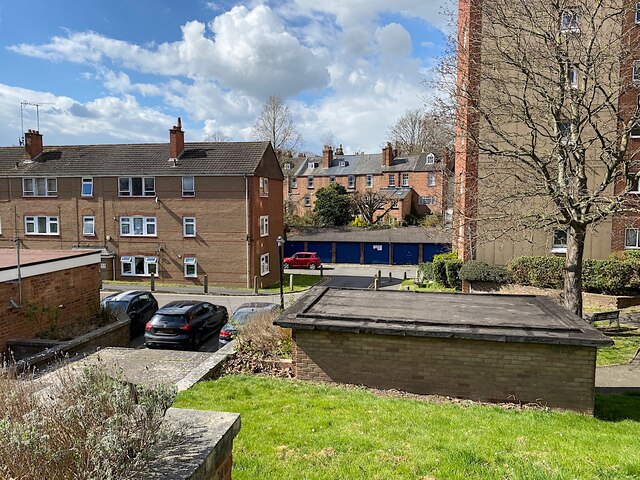
Image: © Robin Stott Taken: 2 Apr 2022
The estate has a block of flats, Westbrook House, right, and three-storey terraces of flats, left. Through the gap can be seen the rear of houses in Woodbine Street. The Milverton Brook ran at the bottom of their back gardens; it was an open sewer until it was culverted in haste during the cholera epidemic of 1849. At that time Brook Street had some of the most appalling, crowded and insanitary housing in the Spa.
Images are licensed for reuse under creativecommons.org/licenses/by-sa/2.0
Image Location
Latitude
52.291066
Longitude
-1.542226