Cuckmere Valley walk [43]
Introduction
The photograph on this page of Cuckmere Valley walk [43] by Michael Dibb as part of the Geograph project.
The Geograph project started in 2005 with the aim of publishing, organising and preserving representative images for every square kilometre of Great Britain, Ireland and the Isle of Man.

There are currently over 7.5m images from over 14,400 individuals and you can help contribute to the project by visiting https://www.geograph.org.uk
Cuckmere Valley walk [43]
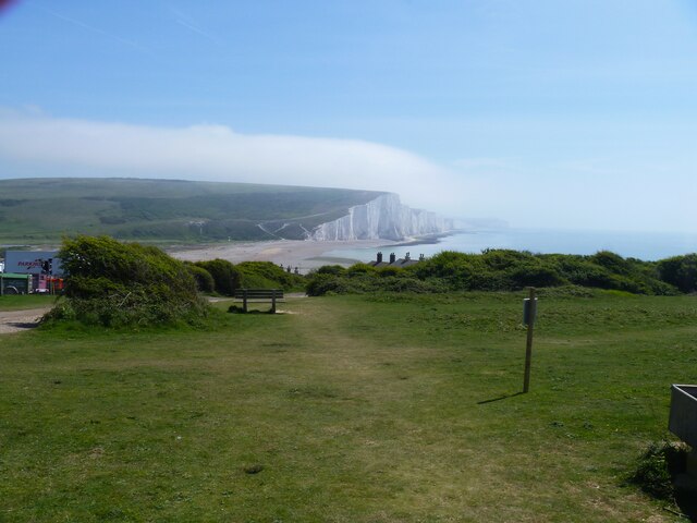
Image: © Michael Dibb Taken: 6 May 2022
Looking down the path to the mouth of the Cuckmere River. The filming vehicles are seen on the right, the chimneys of the Coastguard Cottages are in the centre of the image and the Seven Sisters are seen in the distance. Starting from the car park on South Hill, the route leads south towards the sea then along the cliff tops to Hope Gap, Sleaford Head and Cuckmere Haven. The way is then inland along the bank of the Cuckmere River towards Exceat Bridge, before following the long-distance Vanguard Way back to the starting point. About 4 miles.
Images are licensed for reuse under creativecommons.org/licenses/by-sa/2.0
Image Location
Latitude
50.758617
Longitude
0.144899