Demolition of 2, Lloyd Park Avenue, Croydon
Introduction
The photograph on this page of Demolition of 2, Lloyd Park Avenue, Croydon by Dr Neil Clifton as part of the Geograph project.
The Geograph project started in 2005 with the aim of publishing, organising and preserving representative images for every square kilometre of Great Britain, Ireland and the Isle of Man.

There are currently over 7.5m images from over 14,400 individuals and you can help contribute to the project by visiting https://www.geograph.org.uk
Demolition of 2, Lloyd Park Avenue, Croydon
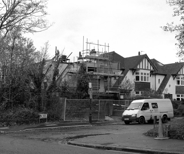
Image: © Dr Neil Clifton Taken: 13 Nov 1997
When the Croydon tram system was constructed, only a few properties (including one or two new ones that had never been occupied) had to be demolished. One example was No 2, Lloyd Park Avenue, which had to be removed to make way for the sharp bend from the former railway alignment onto Coombe Road.
Images are licensed for reuse under creativecommons.org/licenses/by-sa/2.0
Image Location
Latitude
51.364682
Longitude
-0.083042