Track, Pyle on a Wales Coast Path alternative route
Introduction
The photograph on this page of Track, Pyle on a Wales Coast Path alternative route by eswales as part of the Geograph project.
The Geograph project started in 2005 with the aim of publishing, organising and preserving representative images for every square kilometre of Great Britain, Ireland and the Isle of Man.

There are currently over 7.5m images from over 14,400 individuals and you can help contribute to the project by visiting https://www.geograph.org.uk
Track, Pyle on a Wales Coast Path alternative route
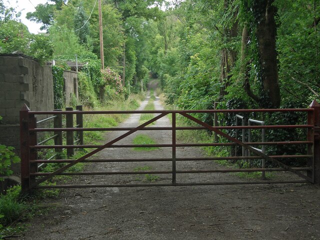
Image: © eswales Taken: 15 Jun 2022
The track seen lies on a stretch of the Wales Coast Path which runs between the south of Kenfig Burrows and Margam via Pyle and is an alternative to walking between the two on the closer-to-the-coast route through the north of Kenfig Burrows and Margam Moors. The idea of the alternative route – which is approximately 11 kilometres long and, like the ‘preferred’ route, marked Wales Coast Path on Ordnance Survey maps - appears to be that it is to be used when weather conditions prevent or make difficult passage along the route via Margam Moors, which is prone to flooding. The gate in the image prevents vehicles travelling further west along the track. Those on foot can continue walking along it by using a stile situated just out of shot to the right of the gate.
Images are licensed for reuse under creativecommons.org/licenses/by-sa/2.0
Image Location
Latitude
51.531297
Longitude
-3.695765