The lighthouse at Scurdie Ness
Introduction
The photograph on this page of The lighthouse at Scurdie Ness by James T M Towill as part of the Geograph project.
The Geograph project started in 2005 with the aim of publishing, organising and preserving representative images for every square kilometre of Great Britain, Ireland and the Isle of Man.

There are currently over 7.5m images from over 14,400 individuals and you can help contribute to the project by visiting https://www.geograph.org.uk
The lighthouse at Scurdie Ness
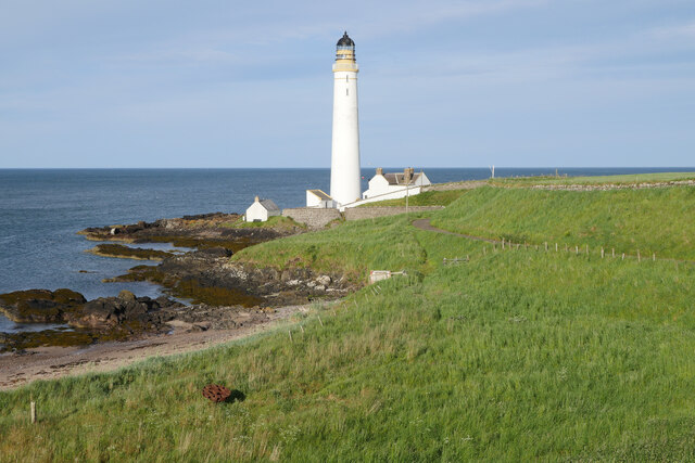
Image: © James T M Towill Taken: 17 Jun 2022
Captured on a beautiful June evening on a short walk from Ferryden. The lighthouse was first lit in March 1870. In the foreground, the iron structure is called 'The Capstan'. An interpretation board nearby provides further information: 'Sailing vessels still went aground on the Annat Bank [after the building of the lighthouse and other infrastructure]. A rocket with a line attached would be fired over the stranded ship and a cable hauled aboard. Teams of horses harnessed to the capstan would attempt to pull the ship off at high tide'. This photograph was taken during the Coronavirus (COVID-19) pandemic of 2020/21/22.
Images are licensed for reuse under creativecommons.org/licenses/by-sa/2.0
Image Location
Latitude
56.701694
Longitude
-2.437477