Rochdale canal before clean up
Introduction
The photograph on this page of Rochdale canal before clean up by Antony McCann as part of the Geograph project.
The Geograph project started in 2005 with the aim of publishing, organising and preserving representative images for every square kilometre of Great Britain, Ireland and the Isle of Man.

There are currently over 7.5m images from over 14,400 individuals and you can help contribute to the project by visiting https://www.geograph.org.uk
Rochdale canal before clean up
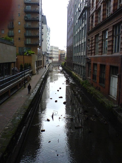
Image: © Antony McCann Taken: 18 Aug 2006
Rochdale canal, part of the Cheshire ring, taken from Oxford Street bridge, just north of Oxford Road station. On the left are modern apartments above retail premises (including a compact Sainsbury's) which front onto Whitworth Street, part of the massive urban renewal in and around central Manchester in the first decade of the 21st century. On the right are office buildings constructed in the first half of the 20th century. The canal, railway and Mancunian Way (inner city motorway) all closely follow the valley of the River Medlock around the southern edge of the city centre. The river itself flows under a bridge immediately south of the railway, which crosses Oxford Street above the river.
Images are licensed for reuse under creativecommons.org/licenses/by-sa/2.0
Image Location


Leaflet Map data © OpenStreetMap
Latitude
53.474975
Longitude
-2.241624