Westham buildings [1]
Introduction
The photograph on this page of Westham buildings [1] by Michael Dibb as part of the Geograph project.
The Geograph project started in 2005 with the aim of publishing, organising and preserving representative images for every square kilometre of Great Britain, Ireland and the Isle of Man.

There are currently over 7.5m images from over 14,400 individuals and you can help contribute to the project by visiting https://www.geograph.org.uk
Westham buildings [1]
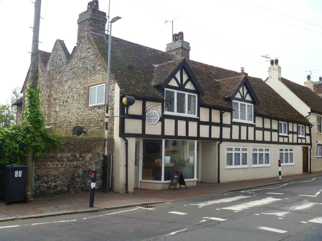
Image: © Michael Dibb Taken: 4 May 2022
Numbers 76 and 76A High Street and Old George House, number 78 High Street (nearer the camera) were built in the 17th century or possibly earlier. The building has been refronted with stucco and imitation timer framing above. All under a tile roof. Listed, grade II, with details at: https://historicengland.org.uk/listing/the-list/list-entry/1353470 The village of Westham is adjacent to the village of Pevensey some five miles (8 km) northeast of Eastbourne. The village is located on a spur of land that was a peninsula that projected into a tidal lagoon, now reclaimed marshland. The village is part of the Greater Eastbourne conurbation, and much recent expansion has taken place. Today it is a commuter village.
Images are licensed for reuse under creativecommons.org/licenses/by-sa/2.0
Image Location
Latitude
50.817459
Longitude
0.327644