Great Wratting: a bend in the B1061
Introduction
The photograph on this page of Great Wratting: a bend in the B1061 by John Sutton as part of the Geograph project.
The Geograph project started in 2005 with the aim of publishing, organising and preserving representative images for every square kilometre of Great Britain, Ireland and the Isle of Man.

There are currently over 7.5m images from over 14,400 individuals and you can help contribute to the project by visiting https://www.geograph.org.uk
Great Wratting: a bend in the B1061
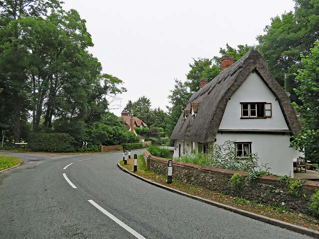
Image: © John Sutton Taken: 30 Jun 2022
The Grade II listing text for the house on the right reads "A C17-C18 timber-framed and plastered house. One storey and attics. Casement windows. Roofs thatched, with two gabled dormers (tiled)". The picture was taken on a cloudy summer morning.
Images are licensed for reuse under creativecommons.org/licenses/by-sa/2.0
Image Location
Latitude
52.106749
Longitude
0.462519