19th Century road sign
Introduction
The photograph on this page of 19th Century road sign by Ian Capper as part of the Geograph project.
The Geograph project started in 2005 with the aim of publishing, organising and preserving representative images for every square kilometre of Great Britain, Ireland and the Isle of Man.

There are currently over 7.5m images from over 14,400 individuals and you can help contribute to the project by visiting https://www.geograph.org.uk
19th Century road sign
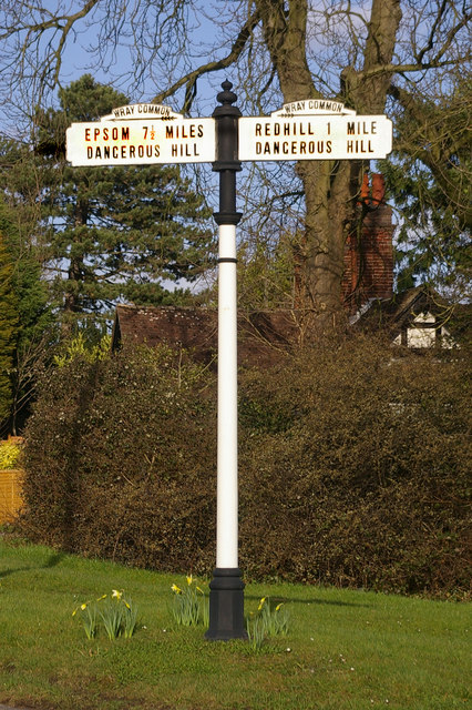
Image: © Ian Capper Taken: 1 Mar 2008
This mid 19th Century cast iron road sign is on Wray Common, Reigate, at the junction of Croydon Road, Batts Hill (the "dangerous hill" to Redhill) and Wray Lane (the "dangerous hill" to Epsom - now used as a cut through to junction 8 on the M25). See Image for a picture of the junction.
Images are licensed for reuse under creativecommons.org/licenses/by-sa/2.0
Image Location


Leaflet Map data © OpenStreetMap
Latitude
51.245598
Longitude
-0.186833