Parapet topping Shrewsbury's town wall
Introduction
The photograph on this page of Parapet topping Shrewsbury's town wall by Richard Law as part of the Geograph project.
The Geograph project started in 2005 with the aim of publishing, organising and preserving representative images for every square kilometre of Great Britain, Ireland and the Isle of Man.

There are currently over 7.5m images from over 14,400 individuals and you can help contribute to the project by visiting https://www.geograph.org.uk
Parapet topping Shrewsbury's town wall
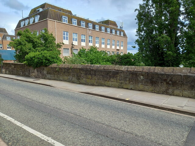
Image: © Richard Law Taken: 22 May 2022
A large section of the 13th century, medieval town wall on the south side of the former boundary of Shrewsbury remains in place, and is built of large sandstone blocks with this road 'Town Walls' being built pretty much on top of it. The wall itself isn't easily visible from the road or the path, but can be seen from the allotments, gardens and tennis courts on the far side of the road (if you can gain access to them...). The parapet wall seen here is a later addition, and in many places is the result of 18th century and later repair work. The whole was Grade II* listed https://britishlistedbuildings.co.uk/101254934-town-walls-shrewsbury#.YrQQZ3bMI2w & https://historicengland.org.uk/listing/the-list/list-entry/1254934 in 1995. The section east of Belmont Crescent is also designated as a Scheduled (Ancient) Monument.
Images are licensed for reuse under creativecommons.org/licenses/by-sa/2.0
Image Location
Latitude
52.705437
Longitude
-2.752388