The former Bowdler's School building
Introduction
The photograph on this page of The former Bowdler's School building by Richard Law as part of the Geograph project.
The Geograph project started in 2005 with the aim of publishing, organising and preserving representative images for every square kilometre of Great Britain, Ireland and the Isle of Man.

There are currently over 7.5m images from over 14,400 individuals and you can help contribute to the project by visiting https://www.geograph.org.uk
The former Bowdler's School building
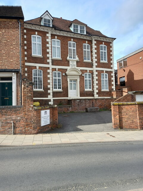
Image: © Richard Law Taken: 22 May 2022
The building is dated 1724, and was originally founded by a local man named Thomas Bowdler, Mayor of the town in the very early 18th century. It attracted a Grade II listing https://britishlistedbuildings.co.uk/101246464-former-bowdlers-school-shrewsbury#.YrQMA3bMI2w & https://historicengland.org.uk/listing/the-list/list-entry/1246464 in 1953, and is currently in use by a dental practice.
Images are licensed for reuse under creativecommons.org/licenses/by-sa/2.0
Image Location
Latitude
52.705959
Longitude
-2.75102