Roade Cutting
Introduction
The photograph on this page of Roade Cutting by Bob Walters as part of the Geograph project.
The Geograph project started in 2005 with the aim of publishing, organising and preserving representative images for every square kilometre of Great Britain, Ireland and the Isle of Man.

There are currently over 7.5m images from over 14,400 individuals and you can help contribute to the project by visiting https://www.geograph.org.uk
Roade Cutting
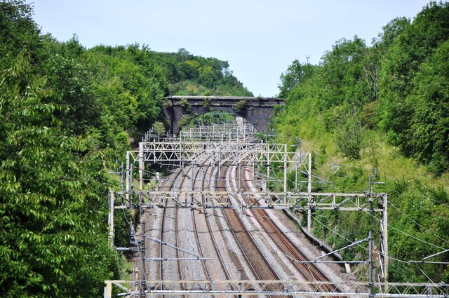
Image: © Bob Walters Taken: 21 Jun 2022
A view north of Roade Cutting from the Hyde Road bridge. The four track West Cost Main Line splits north of the cutting, with the right hand pair of tracks heading for Northampton, while the left hand tracks carry on to Rugby, where the Northampton tracks rejoin the main line.
Images are licensed for reuse under creativecommons.org/licenses/by-sa/2.0
Image Location
Latitude
52.160704
Longitude
-0.901358