Whittlesford: historic houses on West End
Introduction
The photograph on this page of Whittlesford: historic houses on West End by John Sutton as part of the Geograph project.
The Geograph project started in 2005 with the aim of publishing, organising and preserving representative images for every square kilometre of Great Britain, Ireland and the Isle of Man.

There are currently over 7.5m images from over 14,400 individuals and you can help contribute to the project by visiting https://www.geograph.org.uk
Whittlesford: historic houses on West End
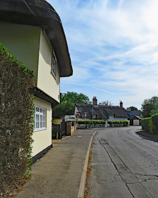
Image: © John Sutton Taken: 17 Jun 2022
Charity Farmhouse, on the left, dates from the early 16th century and the humbler cottages on the corner from a little later. Both are timber-framed, thatched and Grade II listed. Image] (September 2021) is a view towards Charity Farm.
Images are licensed for reuse under creativecommons.org/licenses/by-sa/2.0
Image Location
Latitude
52.111229
Longitude
0.145979