Wayside Cross, Longhope
Introduction
The photograph on this page of Wayside Cross, Longhope by Mr Red as part of the Geograph project.
The Geograph project started in 2005 with the aim of publishing, organising and preserving representative images for every square kilometre of Great Britain, Ireland and the Isle of Man.

There are currently over 7.5m images from over 14,400 individuals and you can help contribute to the project by visiting https://www.geograph.org.uk
Wayside Cross, Longhope
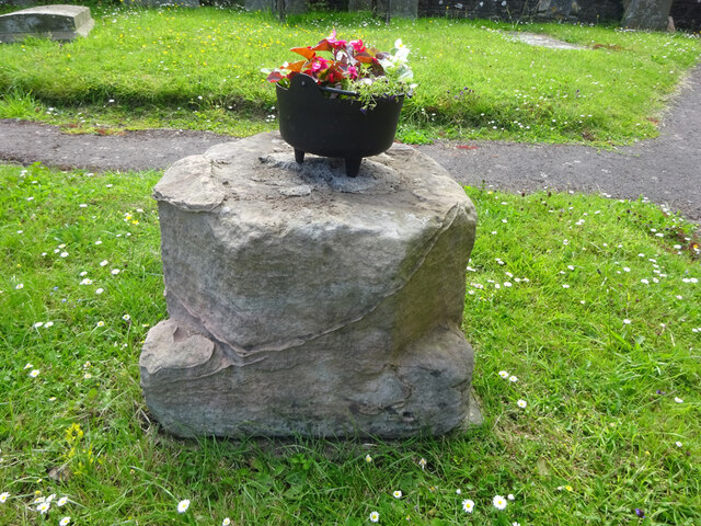
Image: © Mr Red Taken: 14 Jun 2022
In the churchyard, sitting on top of an inspection cover. This is probably the base of a wayside cross once located at SO 69207 18642 in front of what was, in the 1880s, the Plough Inn (long gone). There are more details in the Heritage Gateway site, but the data dates from 1970 when the cross may have been opposite the medieval site. See https://www.heritagegateway.org.uk/Gateway/Results_Single.aspx?uid=6b1d3a87-8b8d-44ba-a26e-785cce394f5c&resourceID=19191 Milestone Society National ID: GLFD_LON
Images are licensed for reuse under creativecommons.org/licenses/by-sa/2.0
Image Location
Latitude
51.875725
Longitude
-2.459699