Old milestone
Introduction
The photograph on this page of Old milestone by Chris Minto as part of the Geograph project.
The Geograph project started in 2005 with the aim of publishing, organising and preserving representative images for every square kilometre of Great Britain, Ireland and the Isle of Man.

There are currently over 7.5m images from over 14,400 individuals and you can help contribute to the project by visiting https://www.geograph.org.uk
Old milestone
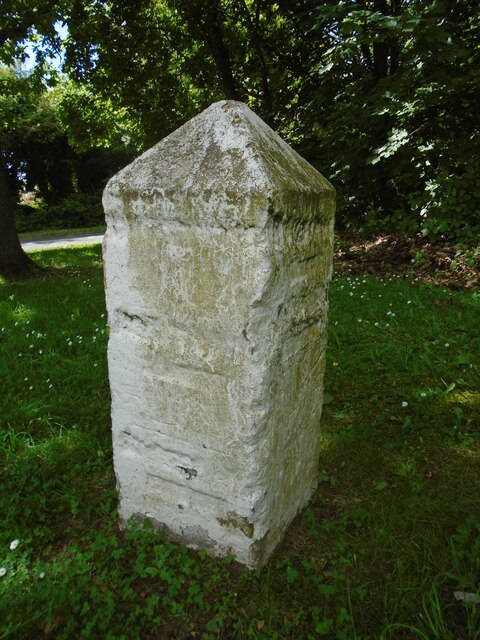
Image: © Chris Minto Taken: 12 Jun 2022
The route between Barnsley, Shepley Lane Head and Holmfirth was never turnpiked. So before County Councils erected milestones in the late 19C/early 20C simple stones would have been set up at junctions to guide travellers. This stone is at the junction of the A635 with North Lane which meanders towards Penistone. It is thought that it was originally inscribed with Penistone, Barnsley and Huddersfield. Although painted in 2015 it is under a large tree hence the green mould. On the day of this picture it was covered with an advertising hoarding, taken off and replaced.
Images are licensed for reuse under creativecommons.org/licenses/by-sa/2.0
Image Location
Latitude
53.560556
Longitude
-1.595824