View of Boddam from Stirling Hill
Introduction
The photograph on this page of View of Boddam from Stirling Hill by Bill Harrison as part of the Geograph project.
The Geograph project started in 2005 with the aim of publishing, organising and preserving representative images for every square kilometre of Great Britain, Ireland and the Isle of Man.

There are currently over 7.5m images from over 14,400 individuals and you can help contribute to the project by visiting https://www.geograph.org.uk
View of Boddam from Stirling Hill
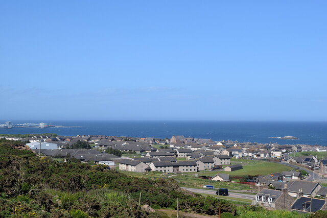
Image: © Bill Harrison Taken: 10 Jun 2022
The uniform grey buildings in the centre are associated with the former RAF Buchan (https://en.wikipedia.org/wiki/RAF_Buchan ) radar station, which closed in 2004. Behind them is the former Boddam parish kirk, now in residential use. In the far distance to the left is part of the Port of Peterhead. The A90 road passes in the foreground.
Images are licensed for reuse under creativecommons.org/licenses/by-sa/2.0
Image Location
Latitude
57.469163
Longitude
-1.782924