Treyford Manor & ruins of St Mary's church
Introduction
The photograph on this page of Treyford Manor & ruins of St Mary's church by David Kemp as part of the Geograph project.
The Geograph project started in 2005 with the aim of publishing, organising and preserving representative images for every square kilometre of Great Britain, Ireland and the Isle of Man.

There are currently over 7.5m images from over 14,400 individuals and you can help contribute to the project by visiting https://www.geograph.org.uk
Treyford Manor & ruins of St Mary's church
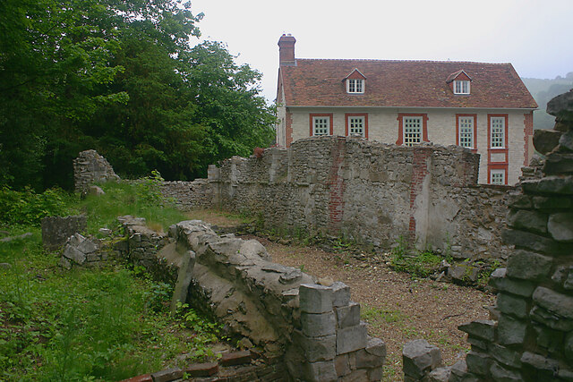
Image: © David Kemp Taken: 7 Jun 2022
The house dates from c.1690-1710 and is currently undergoing major refurbishment and the church from C13. The latter was replaced by a large church in 1849 which was itself demolished in 1951. In 2021 Treyford's postcode district (GU29 0) was stated to have the highest average property prices (£1,438,667) in West Sussex.
Images are licensed for reuse under creativecommons.org/licenses/by-sa/2.0
Image Location
Latitude
50.961567
Longitude
-0.827492