Following the Jubilee Way in Eastbourne [40]
Introduction
The photograph on this page of Following the Jubilee Way in Eastbourne [40] by Michael Dibb as part of the Geograph project.
The Geograph project started in 2005 with the aim of publishing, organising and preserving representative images for every square kilometre of Great Britain, Ireland and the Isle of Man.

There are currently over 7.5m images from over 14,400 individuals and you can help contribute to the project by visiting https://www.geograph.org.uk
Following the Jubilee Way in Eastbourne [40]
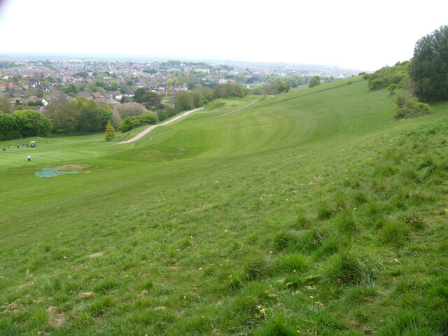
Image: © Michael Dibb Taken: 2 May 2022
The view from the path, looking over the course of the Royal Eastbourne Golf Club. The Jubilee Way runs along the 300-foot contour of the wooded slopes of the South Downs escarpment overlooking Eastbourne. Some 6 miles long, the path runs from Willingdon through meadows and woodland to Eastbourne seafront. The path was named the Jubilee Way in 1977 in celebration of the Queen’s Silver Jubilee. Ash dieback disease has decimated the area.
Images are licensed for reuse under creativecommons.org/licenses/by-sa/2.0
Image Location
Latitude
50.764325
Longitude
0.257049