Alsager Avenue, Rushenden
Introduction
The photograph on this page of Alsager Avenue, Rushenden by Richard Dorrell as part of the Geograph project.
The Geograph project started in 2005 with the aim of publishing, organising and preserving representative images for every square kilometre of Great Britain, Ireland and the Isle of Man.

There are currently over 7.5m images from over 14,400 individuals and you can help contribute to the project by visiting https://www.geograph.org.uk
Alsager Avenue, Rushenden
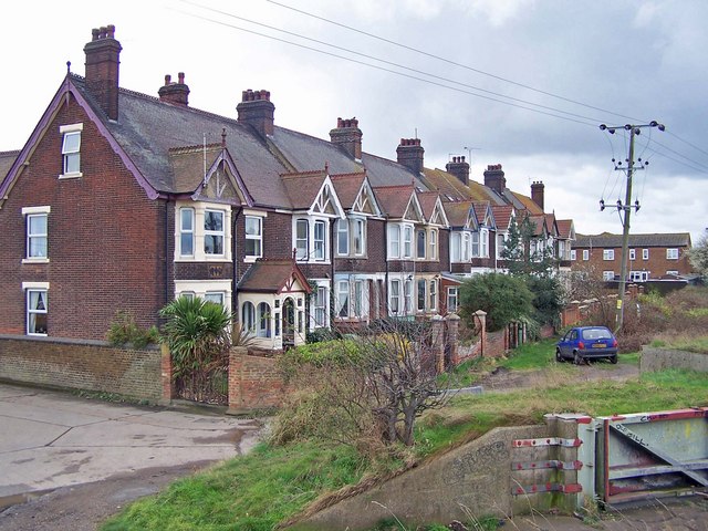
Image: © Richard Dorrell Taken: 9 Mar 2008
This terrace is dated 1912. The houses face Loading Hope Reach in the Swale. There is no road in front of the houses, vehicle access is from Well Road which runs along the backs.
Images are licensed for reuse under creativecommons.org/licenses/by-sa/2.0
Image Location
Latitude
51.410099
Longitude
0.740273