The site of Macduff Railway Station
Introduction
The photograph on this page of The site of Macduff Railway Station by Alan Murray-Rust as part of the Geograph project.
The Geograph project started in 2005 with the aim of publishing, organising and preserving representative images for every square kilometre of Great Britain, Ireland and the Isle of Man.

There are currently over 7.5m images from over 14,400 individuals and you can help contribute to the project by visiting https://www.geograph.org.uk
The site of Macduff Railway Station
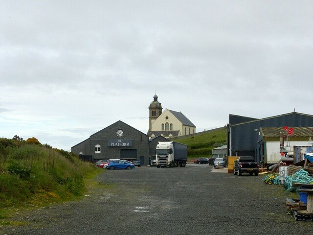
Image: © Alan Murray-Rust Taken: 23 May 2022
'The Platform' is housed in the remaining building which comprised a good shed with passenger facilities alongside, built in 1872 when the line was extended to a new terminus. The station closed to passengers in 1951 and freight in 1961, well before the Beeching era closures. This view https://www.theplatform-macduff.co.uk/datafiles/uploaded/cms_gallery_photo/org/org_11_IMG_1157.JPG courtesy of the Platform website shows the station from a similar view direction. Beyond is Macduff Parish Church, built in 1805 as a chapel of ease in Gamrie Parish, and extended in 1865. It is Listed Category B.
Images are licensed for reuse under creativecommons.org/licenses/by-sa/2.0
Image Location
Latitude
57.666673
Longitude
-2.504689