Safle Eglwys Llandygwydd / St Tygwydd Church site
Introduction
The photograph on this page of Safle Eglwys Llandygwydd / St Tygwydd Church site by Alan Richards as part of the Geograph project.
The Geograph project started in 2005 with the aim of publishing, organising and preserving representative images for every square kilometre of Great Britain, Ireland and the Isle of Man.

There are currently over 7.5m images from over 14,400 individuals and you can help contribute to the project by visiting https://www.geograph.org.uk
Safle Eglwys Llandygwydd / St Tygwydd Church site
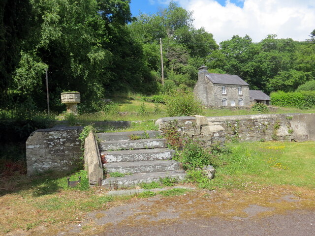
Image: © Alan Richards Taken: 1 Jun 2022
Dim ond stepiau, y bedyddfaen a walydd isel yn unig sy'n goroesi o Eglwys Llandygwydd. Adeiladwyd yr addoldy hwn yn 1856-9. Fe'i dymchwelwyd yn 2000. Mae addolwyr yn cwrdd bellach yn hen ysgoldy'r babanod gerllaw. Only steps, the font and low walls are all that remain of St Tygwydd's church. Built in 1856-9 the church was demolished in 2000. Worshippers now meet in the adjacent former infant schoolroom.
Images are licensed for reuse under creativecommons.org/licenses/by-sa/2.0
Image Location
Latitude
52.064345
Longitude
-4.565436