Wartime air crash memorial near Highashes Lane
Introduction
The photograph on this page of Wartime air crash memorial near Highashes Lane by Bill Boaden as part of the Geograph project.
The Geograph project started in 2005 with the aim of publishing, organising and preserving representative images for every square kilometre of Great Britain, Ireland and the Isle of Man.

There are currently over 7.5m images from over 14,400 individuals and you can help contribute to the project by visiting https://www.geograph.org.uk
Wartime air crash memorial near Highashes Lane
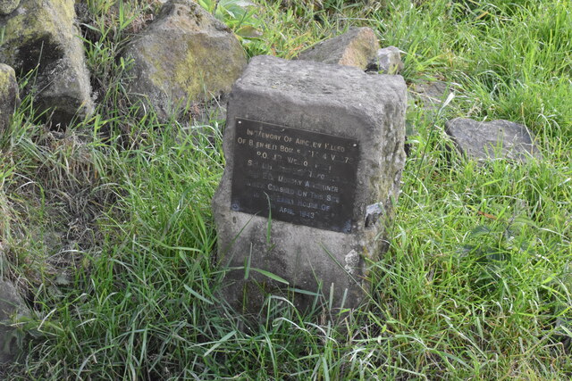
Image: © Bill Boaden Taken: 1 Jun 2022
A Blenheim bomber crashed at this site on 7 April 1943 with the loss of 3 crew.
Images are licensed for reuse under creativecommons.org/licenses/by-sa/2.0
Image Location
Latitude
53.190968
Longitude
-1.485709