View north from Bargoed station
Introduction
The photograph on this page of View north from Bargoed station by Peter Whatley as part of the Geograph project.
The Geograph project started in 2005 with the aim of publishing, organising and preserving representative images for every square kilometre of Great Britain, Ireland and the Isle of Man.

There are currently over 7.5m images from over 14,400 individuals and you can help contribute to the project by visiting https://www.geograph.org.uk
View north from Bargoed station
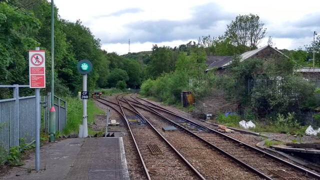
Image: © Peter Whatley Taken: 30 May 2022
The line north of Bargoed was single track when photographed. The line curving left is effectively an elongated "trap point", using the solum of the former route toward Dowlais. The right-most length of track is a siding.
Images are licensed for reuse under creativecommons.org/licenses/by-sa/2.0
Image Location
Latitude
51.693824
Longitude
-3.230878