Bo Klok on the Brook
Introduction
The photograph on this page of Bo Klok on the Brook by Neil Owen as part of the Geograph project.
The Geograph project started in 2005 with the aim of publishing, organising and preserving representative images for every square kilometre of Great Britain, Ireland and the Isle of Man.

There are currently over 7.5m images from over 14,400 individuals and you can help contribute to the project by visiting https://www.geograph.org.uk
Bo Klok on the Brook
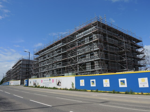
Image: © Neil Owen Taken: 12 May 2022
A long strip of grassland runs beside the brook through this part of Knowle, also marking what became the Airport Road. Having missed the large housing development after WWI, the land has finally been allotted housing development of its own. The developers are a partnership between Skanska and IKEA, and are building a large number of high-density homes for various sorts of owners.
Images are licensed for reuse under creativecommons.org/licenses/by-sa/2.0
Image Location
Latitude
51.423363
Longitude
-2.57581