Inverurie Bridge
Introduction
The photograph on this page of Inverurie Bridge by Alan Murray-Rust as part of the Geograph project.
The Geograph project started in 2005 with the aim of publishing, organising and preserving representative images for every square kilometre of Great Britain, Ireland and the Isle of Man.

There are currently over 7.5m images from over 14,400 individuals and you can help contribute to the project by visiting https://www.geograph.org.uk
Inverurie Bridge
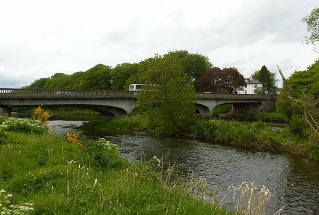
Image: © Alan Murray-Rust Taken: 22 May 2022
The B993 crossing the River Don. Early 20th century replacement for an 18th century predecessor. It was built in 1924 in reinforced concrete on the piers of the previous 18th century stone bridge. The cantilever design means that only minimal forces are transferred to the outer abutments. See also https://www.geograph.org.uk/photo/7183984
Images are licensed for reuse under creativecommons.org/licenses/by-sa/2.0
Image Location
Latitude
57.275488
Longitude
-2.372953