Part of Medieval settlement of Withern: aerial, April 2022 (3)
Introduction
The photograph on this page of Part of Medieval settlement of Withern: aerial, April 2022 (3) by Simon Tomson as part of the Geograph project.
The Geograph project started in 2005 with the aim of publishing, organising and preserving representative images for every square kilometre of Great Britain, Ireland and the Isle of Man.

There are currently over 7.5m images from over 14,400 individuals and you can help contribute to the project by visiting https://www.geograph.org.uk
Part of Medieval settlement of Withern: aerial, April 2022 (3)
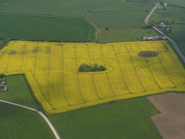
Image: © Simon Tomson Taken: 30 Apr 2022
End of April. See Image See also Image Fields on the corner of Stain Lane, near Strubby. Included in https://www.heritagegateway.org.uk/Gateway/Results_Single.aspx?uid=MLI88311&resourceID=1006 A farm labourer remembered the field before the earthworks were ploughed out - he said they were so pronounced that you could not see the tractor when it was passing through the low parts.
Images are licensed for reuse under creativecommons.org/licenses/by-sa/2.0
Image Location


Leaflet Map data © OpenStreetMap
Latitude
53.323878
Longitude
0.166108