Marriage's Mill
Introduction
The photograph on this page of Marriage's Mill by Glyn Baker as part of the Geograph project.
The Geograph project started in 2005 with the aim of publishing, organising and preserving representative images for every square kilometre of Great Britain, Ireland and the Isle of Man.

There are currently over 7.5m images from over 14,400 individuals and you can help contribute to the project by visiting https://www.geograph.org.uk
Marriage's Mill
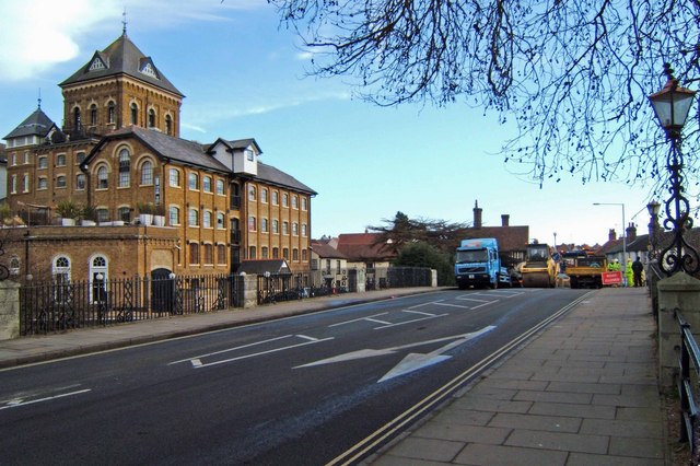
Image: © Glyn Baker Taken: 24 Feb 2008
This is East Bridge Colchester and Marriage’s Mill. After a spell as a Hotel the Mill has now been converted into flats. You can see the roof of Image in the background. Today the bridge was out for resurfacing work.
Images are licensed for reuse under creativecommons.org/licenses/by-sa/2.0
Image Location
Latitude
51.890281
Longitude
0.915475