The Crown Tavern and neighbours
Introduction
The photograph on this page of The Crown Tavern and neighbours by Neil Owen as part of the Geograph project.
The Geograph project started in 2005 with the aim of publishing, organising and preserving representative images for every square kilometre of Great Britain, Ireland and the Isle of Man.

There are currently over 7.5m images from over 14,400 individuals and you can help contribute to the project by visiting https://www.geograph.org.uk
The Crown Tavern and neighbours
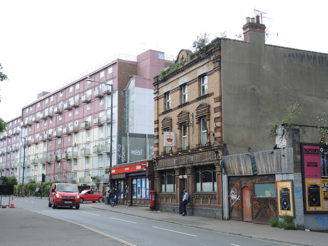
Image: © Neil Owen Taken: 5 May 2022
The pub has stood here for well over a century and has seen many changes all around it. Originally this road was known as Bridewell Road before changing to Lambs Street East and then to Gloucester Road in the late nineteenth century. It used to be part of a typical Victorian terraced suburb but much of the old houses were terrible places and declared slums. They were demolished in the post-war push for better housing and John Cozens House (further on) was part of the new approach.
Images are licensed for reuse under creativecommons.org/licenses/by-sa/2.0
Image Location
Latitude
51.458506
Longitude
-2.5787