South Newton houses [3]
Introduction
The photograph on this page of South Newton houses [3] by Michael Dibb as part of the Geograph project.
The Geograph project started in 2005 with the aim of publishing, organising and preserving representative images for every square kilometre of Great Britain, Ireland and the Isle of Man.

There are currently over 7.5m images from over 14,400 individuals and you can help contribute to the project by visiting https://www.geograph.org.uk
South Newton houses [3]
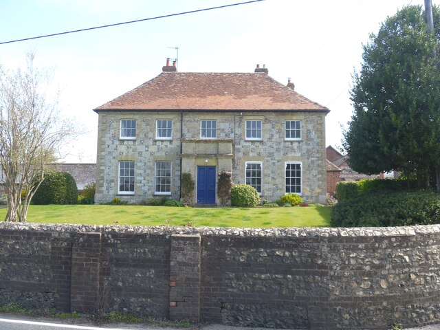
Image: © Michael Dibb Taken: 20 Apr 2022
Manor Farmhouse, Warminster Road, is dated 1799. Constructed of chequered flint and limestone under a hipped tile roof. There is a 20th century rear extension in red brick. Listed, grade II, with details at: https://historicengland.org.uk/listing/the-list/list-entry/1182785 South Newton is a small village 4 miles northwest of Salisbury in Wiltshire. The village straddles the A36 road on the left bank of the River Wylye. Settled since the Saxon period, South Newton is largely a 10th-century estate. A small light industrial estate, a large building maintenance company and a large neurophysiological rehabilitation nursing home provide significant local employment.
Images are licensed for reuse under creativecommons.org/licenses/by-sa/2.0
Image Location


Leaflet Map data © OpenStreetMap
Latitude
51.107239
Longitude
-1.876024