Bottesford Parish Milepost
Introduction
The photograph on this page of Bottesford Parish Milepost by Stephen McKay as part of the Geograph project.
The Geograph project started in 2005 with the aim of publishing, organising and preserving representative images for every square kilometre of Great Britain, Ireland and the Isle of Man.

There are currently over 7.5m images from over 14,400 individuals and you can help contribute to the project by visiting https://www.geograph.org.uk
Bottesford Parish Milepost
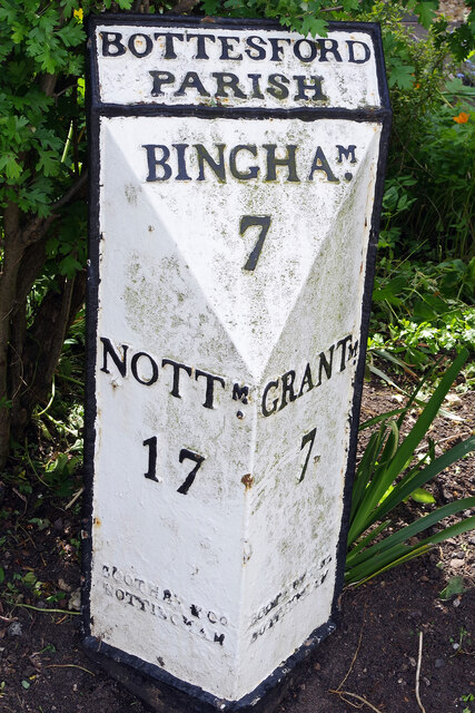
Image: © Stephen McKay Taken: 17 May 2022
The cast iron mile post gives distances to Bingham (7 miles), Nottingham (17 miles) and Grantham (7 miles). It was erected when the main road through Bottesford was a turnpike. With both the Grantham Canal and the railway offering alternatives, wagon traffic had declined by the latter half of the 19th century and the road was de-turnpiked in 1876. Of course, traffic levels were to build up again on what became the A52 and the village eventually got a by-pass in 1989. See also Image
Images are licensed for reuse under creativecommons.org/licenses/by-sa/2.0
Image Location
Latitude
52.941871
Longitude
-0.799234