Benchmark on east parapet of Church Brough Bridge
Introduction
The photograph on this page of Benchmark on east parapet of Church Brough Bridge by Roger Templeman as part of the Geograph project.
The Geograph project started in 2005 with the aim of publishing, organising and preserving representative images for every square kilometre of Great Britain, Ireland and the Isle of Man.

There are currently over 7.5m images from over 14,400 individuals and you can help contribute to the project by visiting https://www.geograph.org.uk
Benchmark on east parapet of Church Brough Bridge
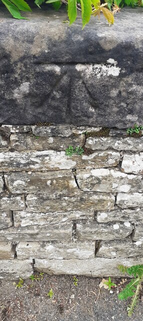
Image: © Roger Templeman Taken: 20 May 2022
Ordnance Survey cut mark benchmark levelled at 173.372m above Newlyn Datum in 1974. The mark was previously levelled at 568.652 feet above Liverpool Datum during the 1844 Penrith to Darlington 1GL Survey. The surveyor's description was 'Branch Levelling from No. 75. Church Brough Bridge. Mark on East battlement ; 3.26 ft. above surface'
Images are licensed for reuse under creativecommons.org/licenses/by-sa/2.0
Image Location
Latitude
54.522442
Longitude
-2.319536