Erith: Manor Way / Slade Green Road
Introduction
The photograph on this page of Erith: Manor Way / Slade Green Road by Nigel Cox as part of the Geograph project.
The Geograph project started in 2005 with the aim of publishing, organising and preserving representative images for every square kilometre of Great Britain, Ireland and the Isle of Man.

There are currently over 7.5m images from over 14,400 individuals and you can help contribute to the project by visiting https://www.geograph.org.uk
Erith: Manor Way / Slade Green Road
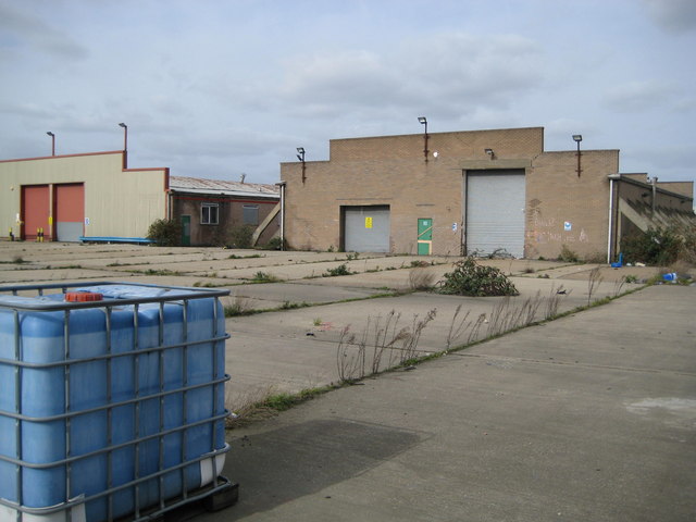
Image: © Nigel Cox Taken: 2 Mar 2008
These derelict works buildings are at the eastern edge of Erith, at the junction of Manor Way and Slade Green Road, and are typical of several in the area where weeds, brambles and buddleia have now taken hold. The building on the right caught my eye by virtue of the large number of concrete buttresses that support both sides of the structure along its full length. Is this because the building was about to collapse or was it part of the original design that some function undertaken inside the unit could have led to a potentially calamitous event? Update December 2011 A correspondent who used to work here in 1988 tells me that "The building with the buttresses at the side is the old GKN Chep pallet factory. This building was the spray shop where the bare wood pallets would be sprayed blue. The container in the foreground is an old paint bin. There is a building next door to this one where the pallets were made."
Images are licensed for reuse under creativecommons.org/licenses/by-sa/2.0
Image Location
Latitude
51.475911
Longitude
0.19451