Baxter Gate, Loughborough
Introduction
The photograph on this page of Baxter Gate, Loughborough by Stephen McKay as part of the Geograph project.
The Geograph project started in 2005 with the aim of publishing, organising and preserving representative images for every square kilometre of Great Britain, Ireland and the Isle of Man.

There are currently over 7.5m images from over 14,400 individuals and you can help contribute to the project by visiting https://www.geograph.org.uk
Baxter Gate, Loughborough
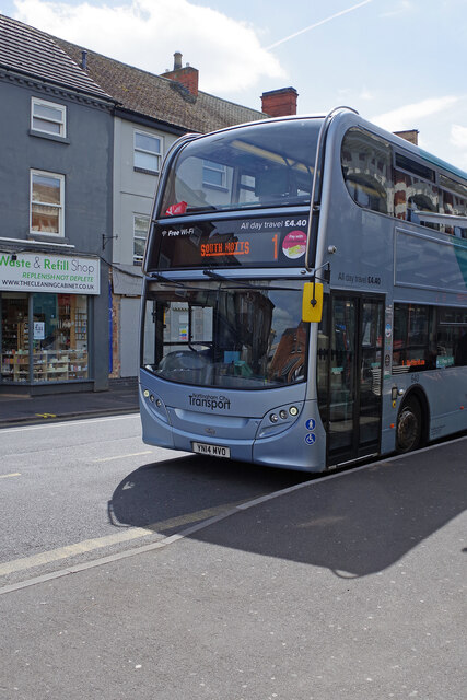
Image: © Stephen McKay Taken: 13 May 2022
A Nottingham City Transport bus awaits departure from the Baxter Gate stop on route 1 to Nottingham. Vehicles on this service are normally branded South Notts but presumably a suitable vehicle was not available on this occasion - although the South Notts name does appear on the destination display. South Notts was a long-established independent operator whose main route was between Nottingham and Loughborough via Gotham and East Leake. It was sold to Nottingham City Transport in 1991 taking the latter well away from its traditional operating area.
Images are licensed for reuse under creativecommons.org/licenses/by-sa/2.0
Image Location
Latitude
52.772138
Longitude
-1.20517