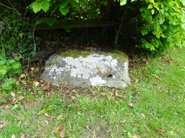
Wayside Cross, Dursley Cross, Longhope
Introduction
The photograph on this page of Wayside Cross, Dursley Cross, Longhope by Mr Red as part of the Geograph project.
The Geograph project started in 2005 with the aim of publishing, organising and preserving representative images for every square kilometre of Great Britain, Ireland and the Isle of Man.
There are currently over 7.5m images from over 14,400 individuals and you can help contribute to the project by visiting https://www.geograph.org.uk

Image: © Mr Red Taken: 12 May 2022
The base of a medieval wayside cross almost in its original position. Most 1840s maps indicate the location is definitely here (contrary to local legend) and some show it in the middle of the triangle where the footpaths and bridleways meet, suggesting this was a Pilgrim Route. What is now Dursley Cross House once served as the Cross Inn. Some maps refer to the locale as "Durse Ley's Cross". Presumably on the same route to Gloucester Cathedral as the cross in Huntley (Image) about 1.6 miles to the East. Milestone Society National ID: GLFD_LON01 Grade II listed monument see https://historicengland.org.uk/listing/the-list/list-entry/1348671

