Langdon Beck Plantation
Introduction
The photograph on this page of Langdon Beck Plantation by Trevor Littlewood as part of the Geograph project.
The Geograph project started in 2005 with the aim of publishing, organising and preserving representative images for every square kilometre of Great Britain, Ireland and the Isle of Man.

There are currently over 7.5m images from over 14,400 individuals and you can help contribute to the project by visiting https://www.geograph.org.uk
Langdon Beck Plantation
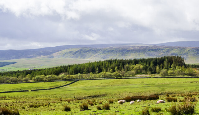
Image: © Trevor Littlewood Taken: 10 May 2022
The coniferous plantation with bushes and a few deciduous trees in front of it seen from the minor road which has crossed from Weardale. (At a location renowned for the spotting of black grouse - we saw some.) Cronkley Scar is in the middle distance with Mickle Fell rising beyond to the right.
Images are licensed for reuse under creativecommons.org/licenses/by-sa/2.0
Image Location
Latitude
54.678427
Longitude
-2.232284