Old Boundary Marker on Passage Road, Henbury
Introduction
The photograph on this page of Old Boundary Marker on Passage Road, Henbury by S Kosciow as part of the Geograph project.
The Geograph project started in 2005 with the aim of publishing, organising and preserving representative images for every square kilometre of Great Britain, Ireland and the Isle of Man.

There are currently over 7.5m images from over 14,400 individuals and you can help contribute to the project by visiting https://www.geograph.org.uk
Old Boundary Marker on Passage Road, Henbury
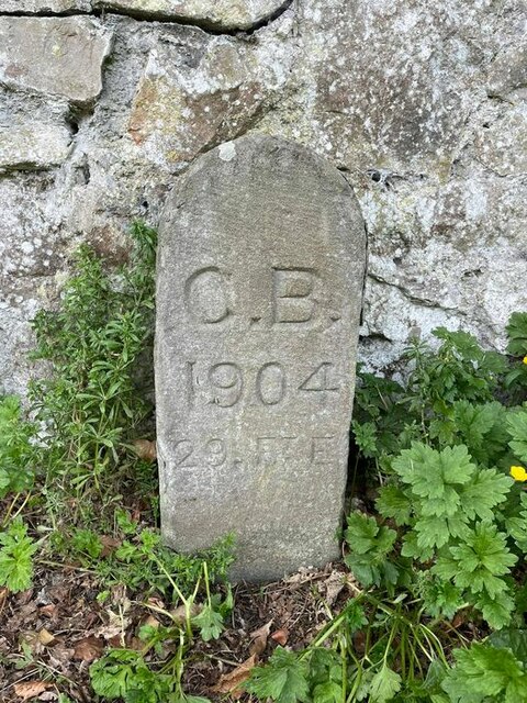
Image: © S Kosciow Taken: 30 Apr 2022
Municipal Boundary Marker against a stone wall on the west side if the A4108 Passage Road in Henbury. On the boundary of Henbury and Westbury upon Trym parishes until 1904 when Westbury upon Trym became part of Bristol parish and borough. In 1935 this part of Henbury parish also became part of Bristol parish and borough. See also https://www.geograph.org.uk/photo/2151786. Milestone Society National ID: GL_BRIS25pb
Images are licensed for reuse under creativecommons.org/licenses/by-sa/2.0
Image Location
Latitude
51.504196
Longitude
-2.615125