Former Bridgeton Free Church
Introduction
The photograph on this page of Former Bridgeton Free Church by Thomas Nugent as part of the Geograph project.
The Geograph project started in 2005 with the aim of publishing, organising and preserving representative images for every square kilometre of Great Britain, Ireland and the Isle of Man.

There are currently over 7.5m images from over 14,400 individuals and you can help contribute to the project by visiting https://www.geograph.org.uk
Former Bridgeton Free Church
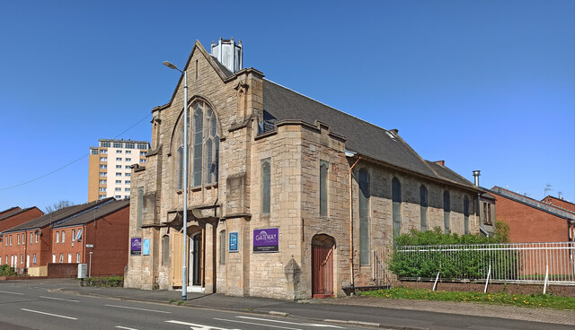
Image: © Thomas Nugent Taken: 22 Apr 2022
A Category B Listed building http://portal.historicenvironment.scot/designation/LB33825 on Dalmarnock Road. Now known as Gateway Church.
Images are licensed for reuse under creativecommons.org/licenses/by-sa/2.0
Image Location
Latitude
55.844827
Longitude
-4.220101