Sheerland House, near Pluckley
Introduction
The photograph on this page of Sheerland House, near Pluckley by Marathon as part of the Geograph project.
The Geograph project started in 2005 with the aim of publishing, organising and preserving representative images for every square kilometre of Great Britain, Ireland and the Isle of Man.

There are currently over 7.5m images from over 14,400 individuals and you can help contribute to the project by visiting https://www.geograph.org.uk
Sheerland House, near Pluckley
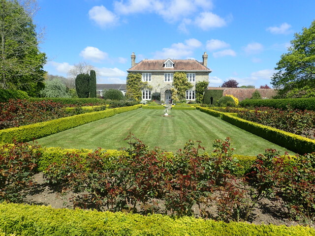
Image: © Marathon Taken: 30 Apr 2022
This attractive and symmetrical house with the ubiquitous Dering windows of Pluckley and Little Chart is seen here from the Greensand Way between Pluckley and Little Chart. Sheerland House forms part of Sheerland Farm. Dering windows are found in Pluckley and surrounding areas, and named after the Dering family. They are identified by their round tops above each casement. It is said that during the Civil War (1642-1652) one of the Royalist members of the Dering family escaped through one of these windows. Considering them lucky, Sir Edward Cholmeley Dering had all the windows on the estate (which included much of the village) replaced with the same style windows. For a little more information on the house see http://www.geograph.org.uk/photo/5225254 The Greensand Ridge provides the highest points in south-east England, rather than the North and South Downs as many people would suppose. The Greensand Way runs from Haslemere in Surrey to Ham Street on the edge of Romney Marsh.
Images are licensed for reuse under creativecommons.org/licenses/by-sa/2.0
Image Location
Latitude
51.174616
Longitude
0.764056