Tuzos, Whyteleafe
Introduction
The photograph on this page of Tuzos, Whyteleafe by Derek Harper as part of the Geograph project.
The Geograph project started in 2005 with the aim of publishing, organising and preserving representative images for every square kilometre of Great Britain, Ireland and the Isle of Man.

There are currently over 7.5m images from over 14,400 individuals and you can help contribute to the project by visiting https://www.geograph.org.uk
Tuzos, Whyteleafe
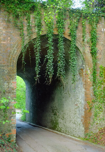
Image: © Derek Harper Taken: 26 Apr 2022
Well Farm Road goes beneath the Oxted railway line. The underline bridge name plate gives this as "SCU1 structure 507 Tuzos". The name must be related to the local family of Tuzo - see https://www.balh.org.uk/news-tuzo-tales-when-researching-a-history-of-whyteleafe-2020-12-10 . The bridge is also shown at Image The hanging strands of ivy appear to have been arranged symmetrically.
Images are licensed for reuse under creativecommons.org/licenses/by-sa/2.0
Image Location
Latitude
51.302381
Longitude
-0.073301