Former Fortrose Parish Church
Introduction
The photograph on this page of Former Fortrose Parish Church by Bill Harrison as part of the Geograph project.
The Geograph project started in 2005 with the aim of publishing, organising and preserving representative images for every square kilometre of Great Britain, Ireland and the Isle of Man.

There are currently over 7.5m images from over 14,400 individuals and you can help contribute to the project by visiting https://www.geograph.org.uk
Former Fortrose Parish Church
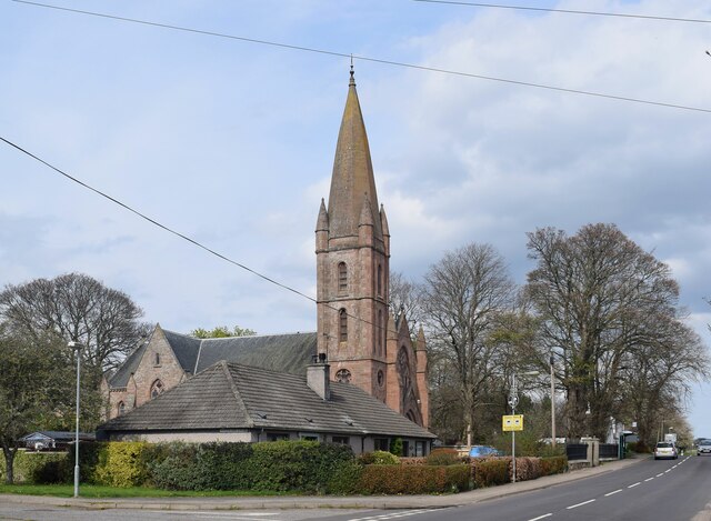
Image: © Bill Harrison Taken: 17 Apr 2022
Built as the free church ca. 1895 and later the (established) parish kirk. Now out of use as the Fortrose congregation has merged with Rosemarkie, a couple of kilometres to the east. B-listed (LB31826 http://portal.historicenvironment.scot/designation/LB31826 ). The A832 road passes in front.
Images are licensed for reuse under creativecommons.org/licenses/by-sa/2.0
Image Location
Latitude
57.583003
Longitude
-4.128912