The King's Head, Earl's Court
Introduction
The photograph on this page of The King's Head, Earl's Court by Stephen McKay as part of the Geograph project.
The Geograph project started in 2005 with the aim of publishing, organising and preserving representative images for every square kilometre of Great Britain, Ireland and the Isle of Man.

There are currently over 7.5m images from over 14,400 individuals and you can help contribute to the project by visiting https://www.geograph.org.uk
The King's Head, Earl's Court
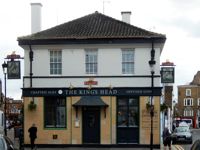
Image: © Stephen McKay Taken: 22 Apr 2022
This pub at the junction of Kenway Road and Hogarth Place, just off Earl's Court Road, has been a Fullers pub since 2015 when it was acquired from Faucet Inns. Note the signs depicting George V in a postage stamp style. There have been licensed premises here since the 17th century but the pub was rebuilt in 1937. See Image for how it looked before it came into Fullers ownership.
Images are licensed for reuse under creativecommons.org/licenses/by-sa/2.0
Image Location
Latitude
51.493398
Longitude
-0.192605