Chester-le-Street: flood alleviation
Introduction
The photograph on this page of Chester-le-Street: flood alleviation by John Sutton as part of the Geograph project.
The Geograph project started in 2005 with the aim of publishing, organising and preserving representative images for every square kilometre of Great Britain, Ireland and the Isle of Man.

There are currently over 7.5m images from over 14,400 individuals and you can help contribute to the project by visiting https://www.geograph.org.uk
Chester-le-Street: flood alleviation
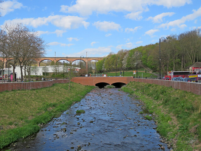
Image: © John Sutton Taken: 23 Apr 2022
Chester (or Cong) Burn was culverted under the Market Place in 1962. Following floods in 2012 this was identified as the main cause and a £6.2m scheme funded by Durham County Council, the Environment Agency and the European Union Regional Development Fund which uncovered the burn should reduce the risk of flooding from exceptional storms. A nearby information board explains that the flood walls north and south of the re-exposed burn increase its capacity, allowing it to hold more water to reduce the risk of flooding. The area has been landscaped to "create a more welcoming, park-like feel". The railway viaduct is in the distance to the left of centre.
Images are licensed for reuse under creativecommons.org/licenses/by-sa/2.0
Image Location
Latitude
54.85899
Longitude
-1.576256