The UK/EU border at Killea
Introduction
The photograph on this page of The UK/EU border at Killea by Rossographer as part of the Geograph project.
The Geograph project started in 2005 with the aim of publishing, organising and preserving representative images for every square kilometre of Great Britain, Ireland and the Isle of Man.

There are currently over 7.5m images from over 14,400 individuals and you can help contribute to the project by visiting https://www.geograph.org.uk
The UK/EU border at Killea
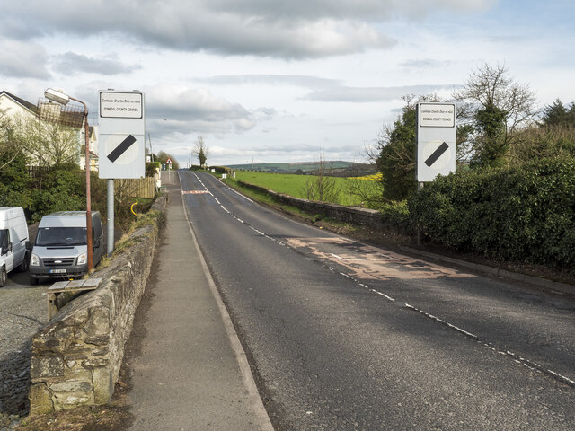
Image: © Rossographer Taken: 16 Apr 2022
The border at Killea, County Donegal. Northern Ireland (the UK) starts a few feet after the national speed limit sign and as you cross from the Irish Republic (EU), the R237 becomes the B193 (still the Letterkenny Road though). As is common with the border across the island, there is nothing else to mark this transition.
Images are licensed for reuse under creativecommons.org/licenses/by-sa/2.0
Image Location
Latitude
54.978276
Longitude
-7.406036