Outer Hope
Introduction
The photograph on this page of Outer Hope by Derek Harper as part of the Geograph project.
The Geograph project started in 2005 with the aim of publishing, organising and preserving representative images for every square kilometre of Great Britain, Ireland and the Isle of Man.

There are currently over 7.5m images from over 14,400 individuals and you can help contribute to the project by visiting https://www.geograph.org.uk
Outer Hope
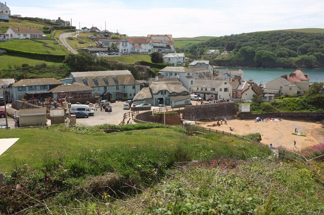
Image: © Derek Harper Taken: 20 Jun 2021
Looking left from Image In the centre is the thatched and listed Mayers (or Bridge Cottage?) https://historicengland.org.uk/listing/the-list/list-entry/1108460?section=official-list-entry . Less prominent is The Cabin, also thatched and listed https://historicengland.org.uk/listing/the-list/list-entry/1169318?section=official-list-entry , on the right.
Images are licensed for reuse under creativecommons.org/licenses/by-sa/2.0
Image Location


Leaflet Map data © OpenStreetMap
Latitude
50.245114
Longitude
-3.858663