Egton High Street
Introduction
The photograph on this page of Egton High Street by Eirian Evans as part of the Geograph project.
The Geograph project started in 2005 with the aim of publishing, organising and preserving representative images for every square kilometre of Great Britain, Ireland and the Isle of Man.

There are currently over 7.5m images from over 14,400 individuals and you can help contribute to the project by visiting https://www.geograph.org.uk
Egton High Street
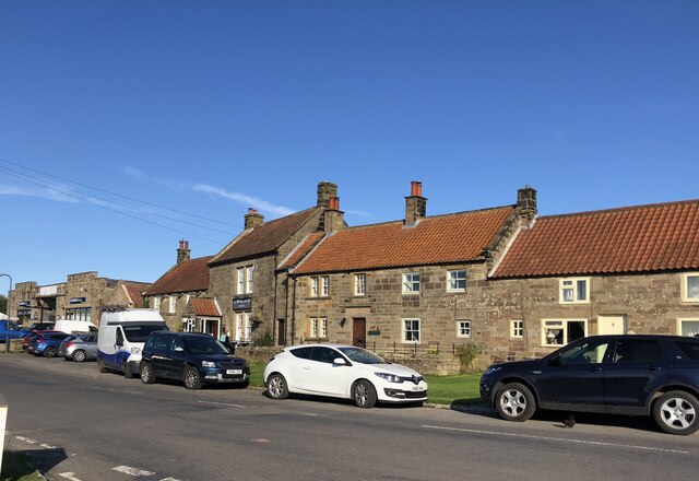
Image: © Eirian Evans Taken: 15 Sep 2021
Three Grade II listed buildings. To the left is the Witching Post Inn dating from C18. Next right is The Forge and then Market Place Cottage both also from early C18.
Images are licensed for reuse under creativecommons.org/licenses/by-sa/2.0
Image Location
Latitude
54.447661
Longitude
-0.755143