
Broken Boundary Marker on Grab Lane
Introduction
The photograph on this page of Broken Boundary Marker on Grab Lane by P Johnstone as part of the Geograph project.
The Geograph project started in 2005 with the aim of publishing, organising and preserving representative images for every square kilometre of Great Britain, Ireland and the Isle of Man.

There are currently over 7.5m images from over 14,400 individuals and you can help contribute to the project by visiting https://www.geograph.org.uk
Broken Boundary Marker on Grab Lane
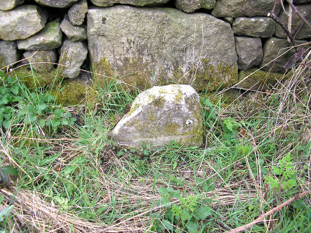
Image: © P Johnstone Taken: Unknown
Badly broken Municipal Boundary Marker in front of a drystone wall on the northwest side of Grab Lane. Only the stump is still visible: the rebate and a rivet hole remain to show what it was. Probably a metal plate with LANCASTER CORPORATION / 1935 / BOROUGH / BOUNDARY in raised lettering is now missing Until 1935 this was on the boundary of Quernmore, Scotforth and Lancaster parishes but in that year the Lancaster and Scotforth boundary was moved eastwards to its current position, as shown on the 25" OS map surveyed in 1938, but not on the 6" map surveyed the same year. Now on the boundary of Lancaster and Quernmore parish. See also https://www.geograph.org.uk/photo/2349146. Milestone Society National ID: LA_LANQUE02pb
Images are licensed for reuse under creativecommons.org/licenses/by-sa/2.0
Image Location

Latitude
54.041297
Longitude
-2.775856