Former Council offices, 60 King Street, Knutsford (6)
Introduction
The photograph on this page of Former Council offices, 60 King Street, Knutsford (6) by Stephen Craven as part of the Geograph project.
The Geograph project started in 2005 with the aim of publishing, organising and preserving representative images for every square kilometre of Great Britain, Ireland and the Isle of Man.

There are currently over 7.5m images from over 14,400 individuals and you can help contribute to the project by visiting https://www.geograph.org.uk
Former Council offices, 60 King Street, Knutsford (6)
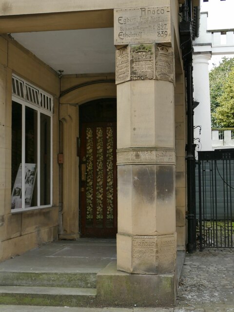
Image: © Stephen Craven Taken: 11 Apr 2022
An octagonal column carved with the names and dates of the Anglo-Saxon, Stuart and Hanoverian monarchs of England/Great Britain. If the names of the medieval period are present, they must be round the back, or a missing piece of stone may have been replaced with a plain one.
Images are licensed for reuse under creativecommons.org/licenses/by-sa/2.0
Image Location
Latitude
53.304122
Longitude
-2.373011