
Old Milestone, B1352, High Street, Mistley
Introduction
The photograph on this page of Old Milestone, B1352, High Street, Mistley by Bob Horlock as part of the Geograph project.
The Geograph project started in 2005 with the aim of publishing, organising and preserving representative images for every square kilometre of Great Britain, Ireland and the Isle of Man.

There are currently over 7.5m images from over 14,400 individuals and you can help contribute to the project by visiting https://www.geograph.org.uk
Old Milestone, B1352, High Street, Mistley
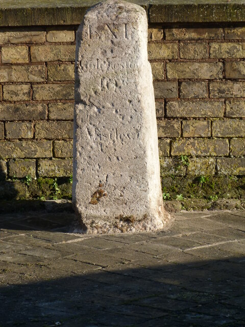
Image: © Bob Horlock Taken: 13 Jan 2022
The milestone was originally located on the High Street, Mistley at TM 1181 3178. It was later moved against the wall of a building on Mistley Quay, see https://www.geograph.org.uk/photo/6045295 , then temporarily put in to store during property development, and has now been re-installed in the Swan Basin, High Street. Parish of Mistley (Tendring District), Carved stone post, originally erected in the 19th century. A replacement for the cast iron post that would later have been fitted to the milestone is located close by, see https://www.geograph.org.uk/photo/7148738 Inscription reads:- LXI / Colchester / 10 / Mistley : : (Harwich / 11) Milestone Society National ID: EX_COHH61
Images are licensed for reuse under creativecommons.org/licenses/by-sa/2.0
Image Location

Latitude
51.944955
Longitude
1.079206