Regency Heights, Park Royal
Introduction
The photograph on this page of Regency Heights, Park Royal by Mark Percy as part of the Geograph project.
The Geograph project started in 2005 with the aim of publishing, organising and preserving representative images for every square kilometre of Great Britain, Ireland and the Isle of Man.

There are currently over 7.5m images from over 14,400 individuals and you can help contribute to the project by visiting https://www.geograph.org.uk
Regency Heights, Park Royal
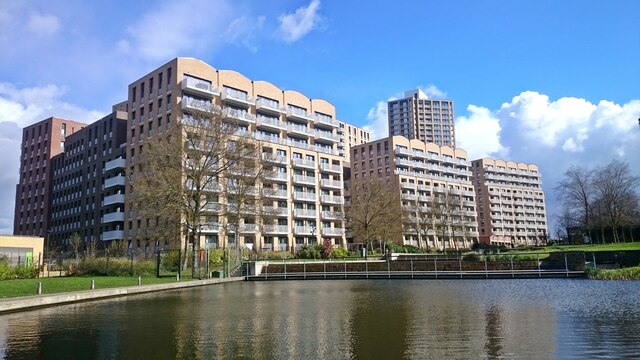
Image: © Mark Percy Taken: 31 Mar 2022
Regency Heights is a housing development built on the site of the former Guinness Brewery on Lakeside Drive. On the 5.5 hectare site are three courtyard blocks called Baronet, Viscount and Marquess House. They contain 499 flats. Planning permission was granted by Brent Council in 2017. The development is a joint venture between Fairview and L&Q.
Images are licensed for reuse under creativecommons.org/licenses/by-sa/2.0
Image Location
Latitude
51.531006
Longitude
-0.283676